Campaign Background
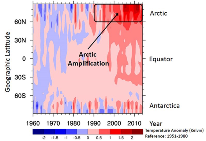
Currently, the Arctic climate is changing at an unprecedented pace and intensity. As an example, a remarkable increase of the Arctic near-surface air temperature has been observed starting about 25 years ago, which exceeds the global warming at least by a factor of two. This phenomenon is commonly referred to as Arctic amplification. The excessive Arctic warming, which is projected to progress during the 21st century, is both a consequence and a driver of feedback processes specific to the Arctic. These interlinked feedback mechanisms cause further partly dramatic climate changes in the Arctic, such as the stronger-than-expected decline of the Arctic sea ice observed since about 1970 and other phenomena. The feedback processes are driven by Arctic-specific and unique conditions, such as pronounced temperature inversions close to the ground, heterogeneous surface properties (open ocean, sea ice), and persisting low-level clouds (often mixed–phase). In addition, there are coupled local feedback mechanisms (surface albedo, water vapour, cloud, lapse rate, and Planck feedback processes), which appear particularly effective in the Arctic. Furthermore, remote feedback processes seem to link the Arctic and the mid-latitudes by meridional transport of heat, humidity, and momentum.
Arctic amplification might cause a weaker jet stream, which would result in an increase of undulations (wavier jet), an amplification of Rossby wave amplitudes, and more blocking situations. These dynamic consequences would promote warm/moist air intrusions and continental cold air outbreaks, which would further amplify the Arctic warming (positive feedback). It is estimated that warm/moist air intrusions increase water vapour and clouds in the winter-time Arctic by 70 % and 30 %, respectively. As a result, more terrestrial downward radiation would heat the near-surface air. The warming is suspected to increase the near-surface air temperature in winter by about 5 K. This warming might trigger an earlier melt onset and more melt ponds, which would decrease surface albedo. Models struggle to represent these effects, and as a consequence, quasi-Langrangian measurements are needed to improve model capabilities.
Quasi-Lagrangian airborne observations during HALO-(AC)³
The HALO campaign studying air-mass transformations in the Arctic is combined with the Transregional Collaborative research Centre SFB/TR 172, called
The general objectives of the HALO-(AC)³ mission are:
- To perform quasi-Lagrange observations of air-mass transformation processes during meridional transports with a particular focus on pronounced warm air intrusions and marine cold air outbreaks, and
- To test the ability of numerical atmospheric models to reproduce the measurements, which then can be applied to investigate the linkages between Arctic amplification and mid-latitude weather.
Figure 1 illustrates the intended observational strategy to achieve the general objective (1.). We will observe the transformation processes of air-mass properties along their poleward pathways over the open water, the marginal sea-ice zone (MIZ), and the sea ice of the Arctic Ocean during warm air intrusions. Vice versa, we will sample the air-mass transformations during southward marine cold air outbreaks from the sea ice, crossing the MIZ, and then moving over the open ocean water. We propose using HALO to follow the air-mass movements in a quasi-Lagrange way, which is unprecedented in the Arctic. HALO is the only research aircraft available in Germany, which has the required endurance (up to 10,000 km; 10 hours) for the planned quasi Lagrange air-mass observations.
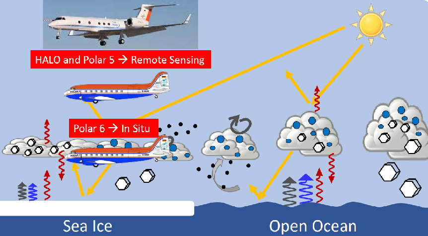
HALO is capable to carry a state-of-the-art set of meteorological and remote sensing instruments (up to 3 t) high enough (up to 15 km) to observe the complete vertical tropospheric air-mass column, including meteorological quantities, turbulence parameters, water vapour, aerosol particles, and clouds. Furthermore, the long endurance of HALO allows to base HALO operations in Kiruna, and not Longyearbyen, which allows observations when poor weather conditions (low cloud base, low visibility, icing in clouds etc.), close to Svalbard prevented to fly out of Longyearbyen which has often been observed in past. HALO will be equipped with a world-class remote sensing payload that has matured in several campaigns. The instrumentation includes a 26-channel microwave radiometer, a Ka-band Doppler radar, and aerosol and DIAL water vapour lidar, spectral and broadband solar and thermal-infrared radiation sensors (upward and downward-looking), imaging camera spectrometers in the solar and thermal-infrared spectral ranges, and dropsondes.
In addition, we will operate (in close collocation with HALO) two further low-flying aircraft (Polar 5: Active and passive remote sensing measurements; and Polar 6: In situ measurements of clouds, aerosol particles, and radiation) funded by AWI to probe smaller-scale processes in the lower troposphere (below 3-5 km altitude). The data collection and analysis of the AWI aircraft data, as well as part of the HALO-
The observations will be realised by measurements of vertical profiles of:
- Meteorological parameters (humidity, temperature) with dropsondes, lidar, and mi- crowave radiometer,
- Aerosol properties (extinction coefficient) using lidar,
- Cloud parameters (thermodynamic phase, LWP, IWP, optical thickness, effective droplet radii, spectral albedo, cloud top altitude, vertical extent) with an EarthCARElike remote sensing package including radar, lidar, microwave radiometer, solar spectral radiometers and imaging solar spectrometers, and
- Energy budget including radiation irradiances using broadband solar and terrestrial radiometers, and turbulent fluxes using the nose boom instrumens.
Dropsonde measurements are crucial for the project. HALO is capable to release dropsondes from high altitudes and in high temporal resolution. They provide accurate in situ measurements and can be released into hazardous environments (e.g., mixed-phase, icing clouds). The measurements with dropsondes include data of wind, temperature, and humidity in an almost perfect vertical profile since the horizontal drift of the drops during their fall (about 10 min fall time) is mostly not larger than about 1 to 10 km. The horizontal speed of the aircraft does not allow to measure strictly on vertical profile patterns. As a consequence, dropsonde measurements are indispensable components for atmospheric profiling using aircraft. Series of dropsonde releases will help to construct vertical cross-sections of temperature, wind, and humidity (including clouds) between the surface and flight level of the aircraft along its track. This will enable to investigate the typical flow regimes in the Arctic.
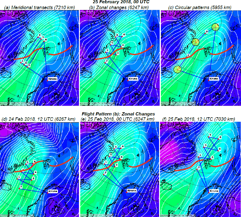
Flight transects are intended to follow an air parcel for at least three consecutive days, and to retrieve the parcel every day. Possible scenarios are illustrated in Figure 3.28. We will track thermodynamic, cloud, and aerosol characteristics along (Figure 3.28 a) and perpendicular (Figure 3.28 b) to the streamlines (trajectories). Dropsonde releases during circular flight pattern (Figure 3.28 c) will serve to obtain large-scale vertical motion. The consecutive tracking of air-masses is schematically illustrated in Figures 3.28 d-f.
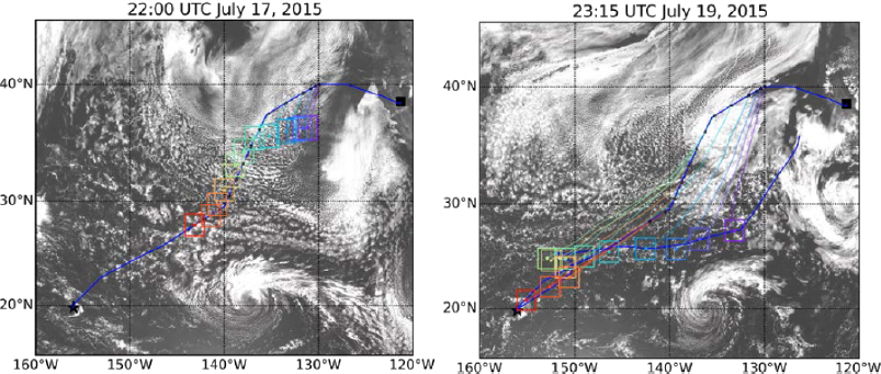
Additionally, Figure 3.29 depicts how trajectory predictions will be used in the flight planning. We will follow a strategy developed within the Cloud System Evolution in the Trades (CSET) project, see http://cseteducation.weebly.com/. Figure 3.29a shows the flight path at the beginning of the observations (blue line). Consecutive flight paths will be performed involving the temporal movements of the individual air parcels (indicated as coloured squares). It will be crucial for the flight planning to involve modelling groups to provide predicted trajectories of the air parcels to be sampled. The strategy is to meet and sample the air parcel along its trajectory as often as possible. This requires sophisticated modelling during the HALO–
The deployment bases of HALO-(AC)³
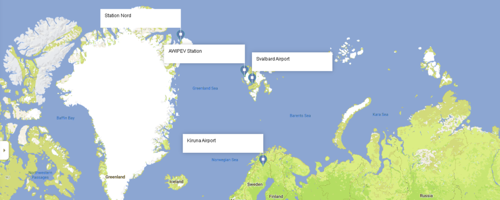
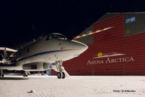
HALO will be based at Arena Arctica in Kiruna (northern Sweden) between 12 March and 15 April 2022. The instrumentation will be installed in Oberpfaffenhofen (December 2021 to February 2022). After obtaining the necessary permissions, HALO will be transferred to Kiruna and perform measurements over a period of five weeks with altogether 142 flight hours (including test flight, EMI certification flight, and transfer to Kiruna). HALO will return to Oberpfaffenhofen in April 2022.
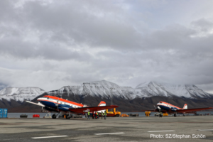
The Polar aircrafts will be based in Longyearbyen (Spitzbergen) between 14 March and 13 April 2022. The instrumentation will be installed in Bremen (February to March 2022).
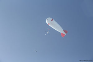
The tethered balloon BELUGA with combined instrument payloads for thermodynamic, turbulence, radiation, as well as cloud and aerosol in-situ measurements will be deployed at the AWIPEV station in Ny-Ålesund (Spitzbergen) between 15 March and 15 May 2022 (not fixed).
The goal of this project is to collect vertical profile data in the cloud-free and cloudy atmospheric boundary layer.